Tracking an Ebola Outbreak in a City Without Maps

Tracking an Ebola Outbreak in a City Without Maps

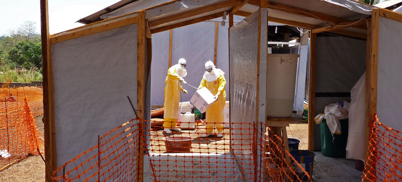
If you Google Map Guéckédou, the Guinean city smack dab in the Ebola virus’s deadly domain right now, you’d see just an abstract blotch of beige and yellow. Zoom all the way in on satellite view, and you can barely make out the outlines of buildings. Don’t even think about trying Street View. Google Maps simply reflects the state of mapping in parts of Guinea. There are no good maps of Guéckédou—until the good folks of the internet help create one.

Read more…


These Amazing Illustrations Are Like Google Maps For 1900s Japan

These Amazing Illustrations Are Like Google Maps For 1900s Japan

Many decades before satellites even existed, a Japanese cartographer named Hatsusaburo Yoshida was drawing cities as though he was floating thousands of feet above them. His vivid, colorful drawings are almost 100 years old now—but they’re just as exciting as they were in 1914.

Read more…


The World’s Most (and Least) Populous Places Revealed In a Single Map

The World's Most (and Least) Populous Places Revealed In a Single Map

We’ve seen a lot of world population maps, but this might just be prettiest one yet. Simple black lines trace the population density by latitude, so that a few cities, labeled in yellow, tower like the skyscrapers over the land. It’s not unlike a cartographical version of Joy Division’s Unknown Pleasures album cover.

Read more…


Spend Your Weekend Gawking at Nearly 700 Old Maps of the U.S.

Spend Your Weekend Gawking at Nearly 700 Old Maps of the U.S.

Okay, history buffs. We’ve got a challenge for you: Learn as much as you possibly can from the 700 odd maps just uploaded to the University of Richmond’s Digital Scholarship Lab. Your brain will thank you later.

Read more…


12 Maps of America From Before We Knew What It Looked Like

12 Maps of America From Before We Knew What It Looked Like

The island of California. A huge triangle of land called Florida. A great ocean that cut down from the Arctic into the Midwest. As the New World came into focus beginning in the 17th century, explorers and cartographers struggled to measure a massive expanse of land that would take centuries to accurately map.

Read more…


7 Brilliant Reinventions of Buckminster Fuller’s Dymaxion Map

7 Brilliant Reinventions of Buckminster Fuller's Dymaxion Map

The world has changed in countless ways since Buckminster Fuller invented the Dymaxion map in 1943. Wars have come and gone, populations have changed, and entire generations have passed. But Bucky’s map endures, thanks to its endless adaptability—and to prove it, the Buckminster Fuller Institute recently invited the public to help reinvent the map for 2013. Today, we get a glimpse at the best entries.

Read more…


The History of the World in 1 Map and 176 Words

Sometimes, simple explanations can be the most revealing. Take this map, for example, which depicts thousands of years of human history by representing each country with a single word. Turns out to be painfully accurate. More »

How Did This Tiny South Pacific Island Disappear? (Hint: It Never Really Existed)

It shows up on Google Maps, coastal databases, and marine charts, but when scientists from the University of Sydney went to visit Sandy Island, it was no where to be found. Did the island, supposedly located between Australia and New Caledonia, suddenly disappear like a confusing LOST plot twist? More »

Could Nokia Win the Map Battle? [Nokia]

Nokia is to be part of a big mapping tie-in with the enterprise giant Oracle. Given the current map furore, and bearing in mind that Nokia Maps is actually good, this could be the Fins’ big chance: maybe, just maybe, Nokia could sneak through the backdoor and claim a victory. More »